Cultural Environment
The Finnish National Board of Antiquities has designated seven nationally significant built cultural environments in Kemi.
The term cultural environment refers to valuable architectural heritage, landscape areas and related landscape attractions, as well as ancient relics. The nationally significant cultural environments of Kemi are located in the town centre, suburbs and peripheral areas.
Grid Area and Church Surroundings
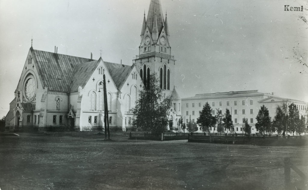
The centre of Kemi, where the church is located, is the only one in Lapland that has been built in accordance with the 19th century grid plan design. The grid structure of the town, divided into fire zones separated by avenues, is still clearly visible. The early 20th-century church and the surrounding school buildings dating back from the turn of the 20th century to the 1950s form an impressive ensemble of public buildings in the town centre. The surviving houses along the avenues and the port area and its buildings, constructed in a period dominated by sailing ships reflect urban construction styles from the turn of the 20th century.
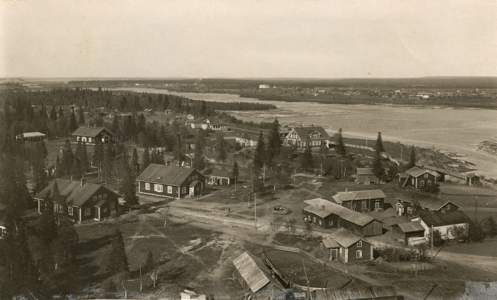
Karihaara Mill Community
The Karihaara mill community is a key site in the industrial history of Northern Finland. It reflects the influence of a major forest industry company (Kemiyhtiö 1893–1991) in Lapland and the company’s ability to meet the housing and service needs of its various personnel groups through its own construction activities between 1900 and 1950.
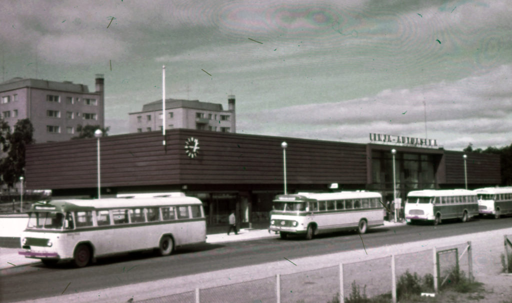
Bus Stations in Central Lapland, Kemi Bus Station
The reconstruction of the bus stations of Kemi, Rovaniemi and Sodankylä, hubs of the Lapland’s bus transport network, after the Second World War is a significant project and phenomenon in our country’s traffic history. Kemi bus station, completed in the early 1960s, is located close to the town hall and the railway station. It is a modern commercial and service space, one of the oldest in the area.
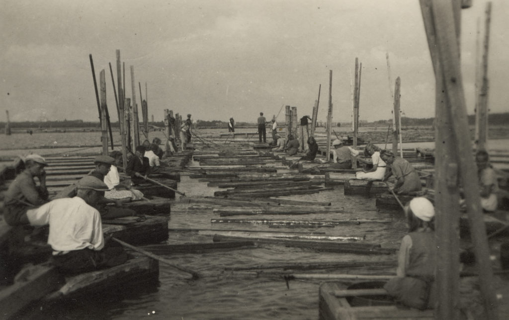
Lapland’s Timber Floating and Logging Sites, Myllyniemi Log Sort Yard
It is common to find logging and timber floating sites and other structures related to timber floating in Lapland’s forest areas. Timber floating became more common in the 1890s and continued in Kemijoki until 1991. As remnants of the flourishing floating and logging industry of the past and its temporal spectrum, you can find cabin mansions, floating cabins, floating dams and boats, as well as devices for moving timber and log sort yards both in Lapland’s forest areas and the coastal regions.
The Myllyniemi log sort yard is one of the largest sort yards in Europe and the most significant area in Kemijoki’s timber floating history. Timber floating continued until 1991. Several buildings remain from the log sorting period, including residential buildings, canteens, reading rooms, workshops, and boat rooms.
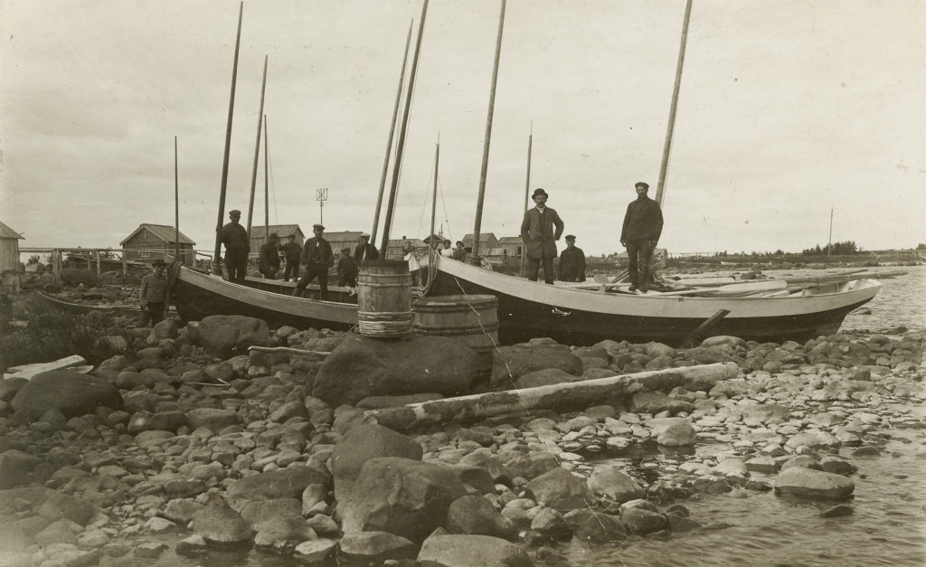
Bay of Bothnia Fishing Harbours and Fishing Bases; Valkiakari, Kuivanuoronkrunni and Selkä-Sarvi
After the main fishing bases of the 18th century stayed on the Swedish side in 1809, Saarenkrunni and Pieni Valkeakari, located off the coast of Kemi, became the largest fishing bases on the Finnish side.
Of the individual islands, Selkä-Sarvi, located near the Swedish border, has also functioned as a long-term fishing base. There is a fishing hut called Ailinpietin Kalamaja on the island, a unique structure representing the 19th century fishing cabin tradition. The stones and rocks on these islands have various carvings, from signatures to dates and compass roses.
Herring and salmon have been fished in the rocky waters of what is currently the Bothnian Bay National Park for centuries. Local islands have been used as seasonal bases for fishing and hunting trips since they first appeared as a result of the land uplift. The way bases have been constructed also reflects the considerable land uplift that has taken place over centuries. Several fishing-related structures, ice cellars, net racks and fish huts remain on the islands.
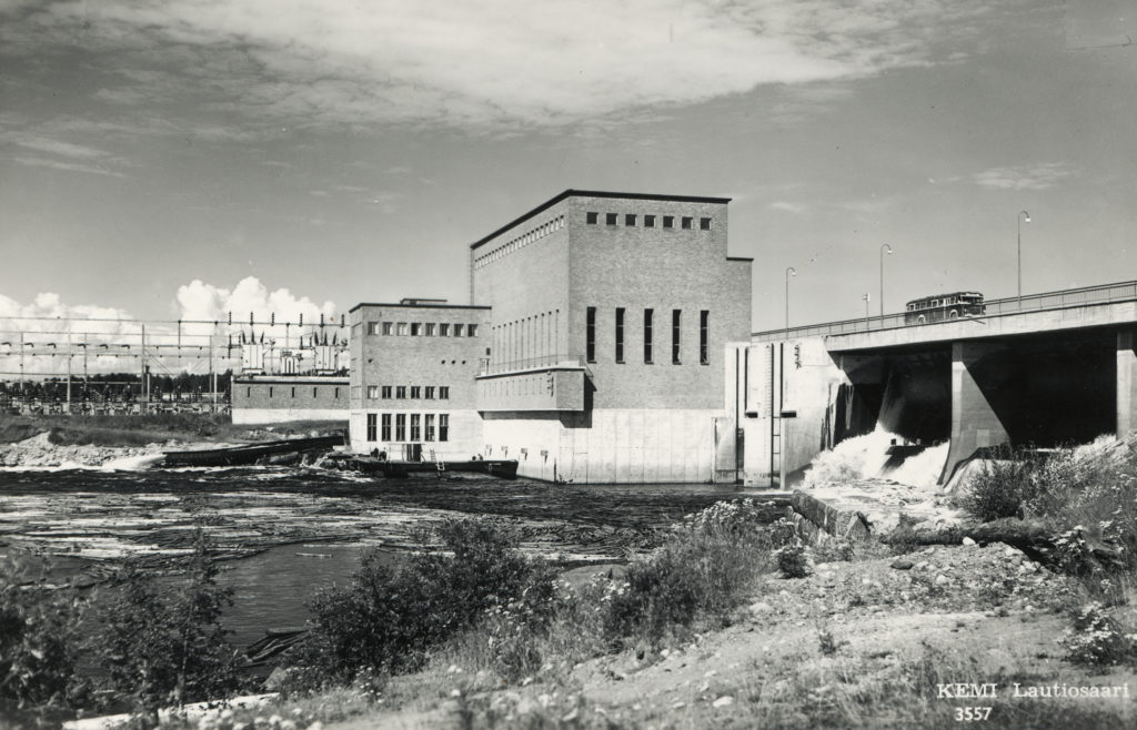
Isohaara Power Plant and Vallitunsaari Power Plant Community
Pohjolan Voima Oy’s Isohaara hydropower plant with its dam bridges and power plant groups is one of the major projects set up during Lapland’s reconstruction period. This power plant, one of the first to use Kemijoki to produce electricity for northern Finland, is of high-quality architectural design. The power plant and its colonies around Kemijoki create a monumental landscape that reflects the reconstruction of Lapland and the development of the energy economy.
Bothnian Coast Road, Kemi
The Bothnian Coast Road is an important historical road in Finland. The road, which was used as a bridleway in the 17th century, runs from Turku to Stockholm around the Gulf of Bothnia. The coastal road was the most important road in Ostrobothnia for a long time. In fact, it used to be the only road in Lapland.
In the Lapland region, almost the entire length of the coastal road, 70 kilometres, is distinguishable in the terrain. The best-preserved sections that are over a kilometre long, where both the initial route and terrain have been preserved, are Onkalonperäntie, Onkalontie, Simonkyläntie, Kirkkotie and Palokankaantie and Viantie in Simo, Hisikankaantie in Keminmaa, and Tornio, and Hietaharjuntie, Laivajärventie and Färimäentie in Tornio. In the municipality of Simo, Simonkyläntie, which has functioned as a summer road since the 17th century, has been included in the Finnish Road Administration’s museum road selection.
In Kemi, remnants of the Bothnian Coast Road can be found at the southern end of the golf course where it appears as a gravel path and an old road bridge over Nauskaoja, originally built in the 1870s.
The current bridge is made of concrete and is called Kuninkaantien silta (‘King’s Road Bridge’).